Mangrove Forest Area by Country: Global Rankings, Distribution and Conservation
Introduction
Mangrove forests are among the most valuable coastal ecosystems on Earth. These distinctive forests grow in tropical and subtropical coastal environments, particularly along sheltered shorelines, river deltas, estuaries, lagoons and tidal wetlands. Unlike most terrestrial trees, mangroves can survive in salty water, waterlogged soils and changing tidal conditions.
Mangrove ecosystems are found across more than 100 countries and territories. They play an important role in protecting coastlines, supporting marine biodiversity, maintaining fisheries and storing carbon. Their dense root systems help stabilize coastal sediments, while their branches and underwater habitats provide shelter and breeding grounds for numerous species.
According to the Food and Agriculture Organization of the United Nations (FAO), the world’s mangrove forests covered approximately 15.9 million hectares in 2025. The Global Mangrove Watch (GMW) provides another important source of satellite-based measurements, including country-level estimates for 2025.
Indonesia has the largest mangrove forest area in the world, followed by Brazil, Australia, Nigeria and Mexico. These countries contain a substantial proportion of the planet’s remaining mangrove ecosystems.
What Are Mangrove Forests?
Mangroves are groups of salt-tolerant trees and shrubs adapted to coastal environments affected by tides. They grow in areas where freshwater from rivers mixes with seawater or where coastal conditions create suitable saline habitats.
Many mangrove species have specialized root systems that allow them to survive in soft, oxygen-poor soil. Some develop exposed roots that help them obtain oxygen, while others have prop roots that provide stability in muddy coastal environments.
Mangrove forests are particularly common in tropical regions because warm temperatures support their growth. However, their distribution also depends on rainfall, freshwater availability, coastal geography, tidal conditions and soil characteristics.
Global Mangrove Forest Area
The world’s mangrove forests cover approximately 15.9 million hectares according to the FAO’s Global Forest Resources Assessment 2025. This is equivalent to about 159,000 square kilometres.
The distribution of mangroves is highly concentrated in tropical coastal regions. Asia contains the largest regional area, followed by Africa, South America, North and Central America, and Oceania.
Indonesia is the world’s leading mangrove country. Its extensive archipelago, tropical climate, river systems and long coastlines provide suitable conditions for large mangrove ecosystems.
Brazil and Australia also have substantial mangrove resources. Nigeria and Mexico complete the five leading countries in the FAO’s 2025 assessment.
The Global Mangrove Watch’s 2025 mapping provides a more detailed country-level comparison. Its estimates are based on satellite mapping and use a different methodology from the FAO’s national reporting system. Consequently, figures from these two sources should not be mixed in a single ranking without explaining the differences.
Countries with the Largest Mangrove Forest Areas
Indonesia
Indonesia has the world’s largest mangrove forest area. Its mangroves extend across numerous islands and coastal regions, particularly in Sumatra, Kalimantan, Sulawesi, Papua and other eastern Indonesian islands.
The country’s mangrove ecosystems are important for coastal fisheries, biodiversity and climate regulation. They provide habitats for fish, crabs, molluscs, birds and other wildlife.
However, mangroves in Indonesia face pressure from aquaculture development, coastal construction, pollution and land conversion. Conservation and restoration programmes are important for protecting these ecosystems.
Brazil
Brazil has the largest mangrove area in South America. Its mangrove ecosystems occur along the Atlantic coastline, especially around estuaries, river deltas and sheltered coastal environments.
The northern coast contains particularly extensive mangrove landscapes. These forests support fisheries, protect coastal settlements and provide habitats for many marine and terrestrial species.
Brazil’s mangroves are also important for carbon storage because their waterlogged soils can preserve organic material for long periods.
Australia
Australia contains one of the world’s largest mangrove areas, particularly along its northern coastline. Mangroves are widespread in Queensland, the Northern Territory and Western Australia.
Australian mangrove forests provide habitats for fish, prawns, crabs, birds and other coastal wildlife. They also help protect shorelines from erosion and wave damage.
Changes in rainfall, sea levels, coastal development and extreme weather can influence the health and distribution of these ecosystems.
Nigeria
Nigeria has Africa’s largest mangrove forest area. Its mangroves are concentrated around the Niger Delta and other coastal wetlands along the Gulf of Guinea.
The Niger Delta is an important ecological region containing extensive tidal creeks, estuaries and wetlands. Mangrove forests support local fishing communities and provide important habitats for wildlife.
Oil pollution, industrial activities, deforestation and urban expansion are among the major environmental pressures affecting Nigerian mangroves.
Mexico
Mexico is one of the world’s leading mangrove countries, with forests distributed along both the Gulf of Mexico and Pacific coastlines.
Important mangrove regions occur around the Yucatán Peninsula, the Gulf Coast and coastal lagoons. These forests support fisheries, protect coastal communities and contribute to biodiversity conservation.
Tourism development, infrastructure construction, pollution and changes in coastal water systems can threaten mangrove habitats.
Mangrove Forest Distribution by Continent
Asia
Asia contains the largest regional concentration of mangrove forests. Southeast Asia is particularly important because of its tropical climate, extensive coastlines, islands and river systems.
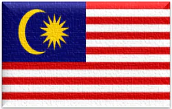
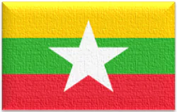
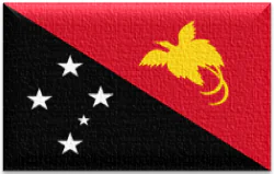
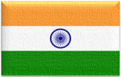
Indonesia is the leading country, while Malaysia, Myanmar, Papua New Guinea, India and Bangladesh also contain major mangrove ecosystems.
The Sundarbans, shared by Bangladesh and India, are among the world’s most recognized mangrove landscapes. This enormous tidal forest supports diverse wildlife and provides natural protection to vulnerable coastal communities.
Other important Asian mangrove regions include the Mekong Delta in Vietnam, coastal wetlands in Myanmar and mangrove areas along the Malaysian coastline.
Africa
Africa has extensive mangrove ecosystems along its western, central and eastern coastlines. Nigeria, Mozambique, Madagascar, Guinea-Bissau, Cameroon and Guinea are among the important mangrove countries.
The Niger Delta is the continent’s most prominent mangrove region. Other significant ecosystems occur along the coasts of East Africa and the western Atlantic coastline.
African mangroves support coastal fisheries, protect shorelines and provide habitats for numerous species. However, pollution, wood harvesting, aquaculture and coastal development threaten many areas.
North and Central America
Mexico is the leading mangrove country in this region. The United States, Belize, Cuba, Panama, Honduras and other Caribbean and Central American countries also contain important mangrove habitats.
Mangroves are particularly common around the Caribbean Sea, Gulf of Mexico and sheltered coastal lagoons.
These forests provide natural barriers against coastal erosion and storms. They also support commercial and local fisheries by providing nursery habitats for marine species.
South America
South America contains extensive mangrove forests, especially along the northern and eastern tropical coastline.
Brazil has the largest national area, followed by important mangrove countries such as Colombia, Venezuela, Ecuador, Suriname and Guyana.
South American mangroves are associated with estuaries, tidal rivers and coastal wetlands. They contribute to biodiversity, fisheries and coastal protection.
Oceania
Australia and Papua New Guinea are the most important mangrove countries in Oceania. Mangrove forests occur across northern Australia and many Pacific island environments.
These ecosystems provide important habitats for fish, crustaceans, birds and other coastal species. They also help protect island communities from shoreline erosion and changing coastal conditions.
Importance of Mangrove Forests
Coastal Protection
Mangrove roots and vegetation help reduce wave energy, stabilize sediments and limit coastal erosion. Healthy mangrove belts can reduce the impact of storms and coastal flooding, although their protection depends on forest width, density, coastal shape and storm intensity.
Marine Biodiversity
Mangroves provide feeding, breeding and nursery habitats for many species. Fish, crabs, prawns, molluscs, reptiles and birds depend on mangrove ecosystems directly or indirectly.
Their connection with seagrass beds and coral reefs also makes them important components of tropical coastal biodiversity.
Carbon Storage
Mangroves are recognized as important blue-carbon ecosystems. They store carbon in their vegetation and especially in the organic-rich soils beneath their roots.
When mangrove forests are destroyed or degraded, stored carbon can be released into the atmosphere. Protecting existing mangroves therefore contributes to climate-change mitigation.
Fisheries and Local Economies
Millions of coastal residents depend directly or indirectly on mangrove ecosystems. These forests support fisheries, provide natural resources and contribute to local livelihoods.
Healthy mangroves can improve the productivity and resilience of nearby coastal fisheries.
Water Quality and Sediment Control
Mangrove roots can trap sediments and help retain some pollutants and nutrients before they spread into nearby coastal waters. This natural filtering function contributes to the health of estuaries and coastal environments.
Major Threats to Mangrove Forests
Despite their ecological importance, mangroves face several threats.
Aquaculture expansion: Conversion of mangrove areas into shrimp and fish farms has caused significant losses in some coastal regions.
Agricultural development: Mangroves may be cleared or drained to create agricultural land.
Urbanization: Ports, roads, tourism facilities and coastal settlements can destroy or fragment mangrove habitats.
Pollution: Oil spills, industrial waste, plastic pollution and untreated wastewater can damage mangrove ecosystems.
Climate change: Sea-level rise, changing rainfall patterns and extreme weather can affect mangrove survival and coastal distribution.
Unsustainable harvesting: Excessive cutting for fuelwood, construction materials and other resources can degrade forests.
The effects differ between countries and regions. Some mangrove areas are declining, while others are expanding naturally or recovering through restoration.
Mangrove Conservation and Restoration
Protecting existing mangrove forests is one of the most effective ways to preserve their ecological benefits. Governments and conservation organizations use protected areas, coastal management policies, restoration programmes and satellite monitoring to improve mangrove conservation.
Successful restoration requires more than planting trees. Projects must consider tidal movement, soil conditions, freshwater supply, suitable species and natural regeneration. Planting mangroves in unsuitable locations can result in poor survival and damage other coastal habitats.
International initiatives, including the Global Mangrove Alliance, encourage governments, research institutions, conservation organizations and local communities to protect and restore mangrove ecosystems.
How Mangrove Forest Area Is Measured
Mangrove area estimates can differ because organizations use different data collection methods.
The FAO’s Global Forest Resources Assessment collects information from national authorities and applies internationally agreed forest definitions and reporting procedures. Its 2025 assessment provides a global estimate of approximately 15.9 million hectares.
Global Mangrove Watch uses satellite observations and mapping methods to estimate mangrove extent and monitor changes over time. Its country-level estimates allow researchers to compare mangrove coverage across countries and examine historical changes.
Differences between the two datasets do not necessarily indicate an error. They may reflect different mapping boundaries, definitions, reference dates, national reporting methods and satellite classification procedures.
For this reason, a country ranking should always identify its data provider and reference year.
Future of the World’s Mangrove Forests
The future of mangrove ecosystems depends on effective coastal management, conservation investment and cooperation between governments and local communities.
Countries with large mangrove areas have a particularly important role in global conservation. Indonesia, Brazil, Australia, Nigeria and Mexico contain substantial mangrove resources, but smaller mangrove countries also contribute to regional biodiversity and coastal resilience.
Improved satellite monitoring, stronger environmental laws, sustainable fisheries and carefully planned restoration can help protect these forests.
Conclusion
Mangrove forests are essential coastal ecosystems that support biodiversity, protect shorelines, store carbon and sustain coastal livelihoods. Their global distribution is concentrated in tropical regions, with Asia holding the largest regional share.
Indonesia has the world’s largest mangrove forest area, while Brazil, Australia, Nigeria and Mexico are also among the leading countries. Reliable data from the FAO and Global Mangrove Watch provide important evidence for understanding the distribution and condition of these ecosystems.
Protecting existing mangrove forests and restoring degraded coastal habitats will be essential for preserving biodiversity, strengthening coastal resilience and supporting communities around the world.
Frequently Asked Questions
Which country has the largest mangrove forest area?
Indonesia has the largest mangrove forest area in the world, according to both FAO and Global Mangrove Watch assessments.
Which continent has the largest mangrove area?
Asia has the largest regional mangrove area, with extensive forests across Southeast Asia and South Asia.
What are the five countries with the largest mangrove forests?
Indonesia, Brazil, Australia, Nigeria and Mexico are the five leading countries in the FAO’s 2025 assessment.
What is the global area of mangrove forests?
The FAO estimated approximately 15.9 million hectares of mangrove forest worldwide in 2025.
Why are mangrove forests important?
Mangroves protect coastlines, support fisheries, provide wildlife habitats, improve coastal water conditions and store carbon in vegetation and soil.
Are mangrove forests found in Pakistan?
Yes. Pakistan has mangrove forests mainly along the Indus Delta in Sindh, with smaller mangrove areas along parts of the Balochistan coast. The Indus Delta is an important mangrove ecosystem in the northern Arabian Sea.
What is the biggest threat to mangrove forests?
Major threats include aquaculture expansion, land conversion, coastal development, pollution, unsustainable harvesting and climate-related changes.
What is blue carbon?
Blue carbon refers to carbon captured and stored by coastal and marine ecosystems, including mangroves, seagrass meadows and tidal marshes.