
bangladesh division district list : all division and district of bangladesh
top most populous division of bangladesh
01
Dhaka
45 Million
02
Chittagong (Chattogram)
34 Million
03
Rajshahi
20 Million
04
Rangpur
18 Million
05
Khulna
17 Million
06
Mymensingh
12 Million
07
Sylhet
11 Million
08
Barishal
9.3 Million
Provinces Of Bangladesh Ranking By population
Bangladesh has eight divisions. Each division contains several districts, which are further divided into upazilas and other local administrative units.
| S no. | Name | Status | Population 2022 | Population 2011 |
|---|---|---|---|---|
| 1 | Dhaka | Div | 45,644,586 | 37,893,924 |
| 2 | Chittagong (Chattogram) | Div | 34,178,612 | 29,553,857 |
| 3 | Rajshahi | Div | 20,794,019 | 19,225,905 |
| 4 | Rangpur | Div | 18,020,071 | 16,412,280 |
| 5 | Khulna | Div | 17,813,218 | 16,309,303 |
| 6 | Dhaka | Dist | 15,210,851 | 12,517,360 |
| 7 | Mymensingh | Div | 12,637,472 | 11,427,765 |
| 8 | Sylhet | Div | 11,415,113 | 10,296,995 |
| 9 | Chittagong (Chattogram) | Dist | 9,439,076 | 7,913,366 |
| 10 | Barishal | Div | 9,325,820 | 8,652,321 |
| 11 | Cumilla | Dist | 6,394,875 | 5,602,624 |
| 12 | Mymensingh | Dist | 6,097,814 | 5,313,163 |
| 13 | Gazipur | Dist | 5,433,538 | 3,548,115 |
| 14 | Tangail | Dist | 4,168,083 | 3,749,086 |
| 15 | Narayanganj | Dist | 4,035,461 | 3,074,078 |
| 16 | Sylhet | Dist | 3,990,003 | 3,567,139 |
| 17 | Bogra | Dist | 3,815,192 | 3,539,293 |
| 18 | Noakhali | Dist | 3,732,042 | 3,231,832 |
| 19 | Sirajganj | Dist | 3,430,443 | 3,220,812 |
| 20 | Brahmanbaria | Dist | 3,403,786 | 2,953,208 |
| 21 | Dinajpur | Dist | 3,392,251 | 3,109,626 |
| 22 | Kishoreganj | Dist | 3,373,219 | 3,028,706 |
| 23 | Rangpur | Dist | 3,243,247 | 2,996,334 |
| 24 | Jessore | Dist | 3,146,317 | 2,876,380 |
| 25 | Rajshahi | Dist | 2,978,156 | 2,699,688 |
| 26 | Pabna | Dist | 2,972,654 | 2,624,683 |
| 27 | Cox's Bazar | Dist | 2,906,281 | 2,381,814 |
| 28 | Naogaon | Dist | 2,844,921 | 2,701,906 |
| 29 | Sunamganj | Dist | 2,788,358 | 2,564,540 |
| 30 | Chandpur | Dist | 2,713,247 | 2,513,838 |
| 31 | Khulna | Dist | 2,673,002 | 2,407,679 |
| 32 | Narsingdi | Dist | 2,667,968 | 2,314,889 |
| 33 | Barishal | Dist | 2,634,203 | 2,414,729 |
| 34 | Gaibandha | Dist | 2,621,756 | 2,471,680 |
| 35 | Jamalpur | Dist | 2,583,984 | 2,384,811 |
| 36 | Habiganj | Dist | 2,440,151 | 2,171,065 |
| 37 | Netrakona [Netrokona] | Dist | 2,403,205 | 2,317,190 |
| 38 | Kurigram | Dist | 2,383,268 | 2,150,974 |
| 39 | Satkhira | Dist | 2,246,691 | 2,063,610 |
| 40 | Faridpur | Dist | 2,232,772 | 1,988,695 |
| 41 | Kushtia | Dist | 2,198,731 | 2,023,657 |
| 42 | Maulvi Bazar [Moulvibazar] | Dist | 2,196,601 | 1,994,252 |
| 43 | Nilphamari | Dist | 2,141,180 | 1,907,497 |
| 44 | Jhenaidah | Dist | 2,051,607 | 1,842,573 |
| 45 | Lakshmipur | Dist | 1,994,930 | 1,797,761 |
| 46 | Bhola | Dist | 1,980,452 | 1,846,351 |
| 47 | Natore | Dist | 1,900,213 | 1,774,832 |
| 48 | Chapai Nawabganj | Dist | 1,875,290 | 1,714,249 |
| 49 | Patuakhali | Dist | 1,770,096 | 1,596,223 |
| 50 | Feni | Dist | 1,697,379 | 1,496,139 |
| 51 | Munshiganj | Dist | 1,677,941 | 1,502,449 |
| 52 | Bagerhat | Dist | 1,649,874 | 1,534,012 |
| 53 | Manikganj | Dist | 1,608,372 | 1,447,301 |
| 54 | Thakurgaon | Dist | 1,569,529 | 1,444,783 |
| 55 | Sherpur | Dist | 1,552,469 | 1,412,601 |
| 56 | Lalmonirhat | Dist | 1,461,589 | 1,305,248 |
| 57 | Gopalganj | Dist | 1,336,907 | 1,218,319 |
| 58 | Shariatpur | Dist | 1,336,396 | 1,201,464 |
| 59 | Madaripur | Dist | 1,334,811 | 1,212,199 |
| 60 | Chuadanga | Dist | 1,262,205 | 1,174,836 |
| 61 | Rajbari | Dist | 1,228,267 | 1,091,263 |
| 62 | Pirojpur | Dist | 1,227,915 | 1,157,215 |
| 63 | Panchagarh | Dist | 1,207,252 | 1,026,139 |
| 64 | Magura | Dist | 1,056,683 | 954,804 |
| 65 | Barguna | Dist | 1,035,596 | 927,889 |
| 66 | Jaipurhat [Joypurhat] | Dist | 977,150 | 950,440 |
| 67 | Narail | Dist | 806,662 | 750,425 |
| 68 | Khagrachhari | Dist | 735,116 | 638,967 |
| 69 | Meherpur | Dist | 721,447 | 681,331 |
| 70 | Jhalakati [Jhalokati] | Dist | 677,559 | 709,914 |
| 71 | Rangamati | Dist | 666,627 | 620,215 |
| 72 | Bandarban | Dist | 495,252 | 404,091 |
| Total | Bangladesh | PRep | 169,828,911 | 149,772,364 |
| Source : Bangladesh Provinces | citypopulation.de | ||||
largest division in bangladesh by population
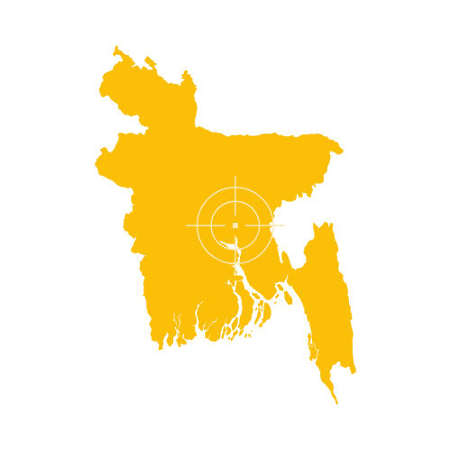
Dhaka is the most populous division of Bangladesh, with a population of approximately 45 million people
Bangladesh Historical Population Growth : has grown significantly over the decades
Bangladesh Divisions and Districts
Introduction
Bangladesh is divided into 8 administrative divisions and 64 districts, forming the country’s main administrative structure. Divisions are the largest administrative units, while districts are the principal subdivisions within each division.
The eight divisions of Bangladesh are Barishal, Chattogram, Dhaka, Khulna, Mymensingh, Rajshahi, Rangpur, and Sylhet. Among them, Dhaka is the most populous division, while Barishal is the least populous according to the 2022 census figures presented by City Population.
Bangladesh had a total population of 169,828,911 in the 2022 census dataset used by City Population. The population figures are based on Bangladesh Bureau of Statistics data, with the district figures adjusted using the official adjustment factors of the corresponding divisions.
1. Dhaka Division
Dhaka Division is the most populous administrative division of Bangladesh. It had a population of 45,644,586 in the 2022 census dataset and covers approximately 20,509 square kilometers. The division contains 13 districts.
Districts of Dhaka Division
- Dhaka
- Faridpur
- Gazipur
- Gopalganj
- Kishoreganj
- Madaripur
- Manikganj
- Munshiganj
- Narayanganj
- Narsingdi
- Rajbari
- Shariatpur
- Tangail
Dhaka district contains the national capital and is one of the country’s most important centers for government, commerce, finance, education, transportation, and industry.
The City Population database also provides detailed population information for individual administrative areas within Dhaka Division. For example, its data for Narsingdi district and other districts are based on Bangladesh Bureau of Statistics census results.
2. Chattogram Division
Chattogram Division, also spelled Chittagong Division, is the largest division of Bangladesh by area among the eight divisions. It covers approximately 33,915 square kilometers and had a 2022 population of 34,178,612.
Districts of Chattogram Division
Bandarban
Brahmanbaria
Chandpur
Chattogram
Cumilla
Cox’s Bazar
Feni
Khagrachhari
Lakshmipur
Noakhali
Rangamati
Chattogram is an important economic and transportation center, while Cox’s Bazar is internationally known for its long natural sea beach. The hill districts of Bandarban, Khagrachhari, and Rangamati form an important part of southeastern Bangladesh.
City Population’s administrative data identifies Chattogram as a division and provides population information for its districts and lower-level administrative areas.
3. Rajshahi Division
Rajshahi Division covers about 18,155 square kilometers and had a population of 20,794,019 in the 2022 census dataset. It contains eight districts.
Districts of Rajshahi Division
Bogra
Joypurhat
Naogaon
Natore
Chapai Nawabganj
Pabna
Rajshahi
Sirajganj
Rajshahi Division is located in northwestern Bangladesh and is known for agriculture, river systems, historical sites, education, and major urban centers.
City Population’s district-level records include population statistics for districts such as Bogra, Naogaon, Natore, Pabna, and Sirajganj.
4. Rangpur Division
Rangpur Division covers approximately 16,185 square kilometers. Its population reached 18,020,071 in the 2022 census dataset and it contains eight districts.
Districts of Rangpur Division
Dinajpur
Gaibandha
Kurigram
Lalmonirhat
Nilphamari
Panchagarh
Rangpur
Thakurgaon
Rangpur Division occupies the northern part of Bangladesh and has a predominantly agricultural economy. Rangpur, Dinajpur, Kurigram, and other districts form important population and agricultural centers in northern Bangladesh.
City Population records include district and subdistrict population data for Rangpur Division, including Dinajpur and Kurigram.
5. Khulna Division
Khulna Division covers approximately 22,270 square kilometers and had a population of 17,813,218 in the 2022 census dataset. It consists of 10 districts.
Districts of Khulna Division
Bagerhat
Chuadanga
Jashore
Jhenaidah
Khulna
Kushtia
Magura
Meherpur
Narail
Satkhira
Khulna Division occupies much of southwestern Bangladesh. It includes areas connected with the Sundarbans, one of the world’s most important mangrove ecosystems.
Khulna is also a major urban and industrial center. City Population records the population of Khulna City Corporation separately, including its city districts and wards.
6. Mymensingh Division
Mymensingh Division covers approximately 10,670 square kilometers and had a population of 12,637,472 in the 2022 census dataset. It contains four districts.
Districts of Mymensingh Division
Jamalpur
Mymensingh
Netrokona
Sherpur
Mymensingh Division is located in north-central Bangladesh. Agriculture, river systems, education, and rural settlements are important characteristics of the region.
The City Population database provides detailed census information for the division and its districts and lower-level administrative units.
7. Sylhet Division
Sylhet Division covers about 12,635 square kilometers and had a population of 11,415,113 in the 2022 census dataset. It contains four districts.
Districts of Sylhet Division
Habiganj
Moulvibazar
Sunamganj
Sylhet
Sylhet Division is located in northeastern Bangladesh and is known for its tea-growing areas, wetlands, hills, rivers, and large communities with international connections.
Sylhet district and Sylhet city are major population centers in the division.
8. Barishal Division
Barishal Division is located in southern Bangladesh and covers approximately 13,225 square kilometers. It had a population of 9,325,820 in the 2022 census dataset, making it the least populous of Bangladesh’s eight divisions by this measure.
Districts of Barishal Division
Barguna
Barishal
Bhola
Jhalokati
Patuakhali
Pirojpur
Barishal Division is characterized by extensive rivers, canals, wetlands, agricultural land, and coastal areas. Barishal city serves as an important administrative and commercial center.
City Population’s administrative data includes detailed census information for districts and lower-level areas within Barishal Division.
Bangladesh Divisions by Population
Based on the 2022 census figures presented by City Population, the divisions of Bangladesh can be ranked by population as follows:
| Rank | Division | Population 2022 |
|---|---|---|
| 1 | Dhaka | 45,644,586 |
| 2 | Chattogram | 34,178,612 |
| 3 | Rajshahi | 20,794,019 |
| 4 | Rangpur | 18,020,071 |
| 5 | Khulna | 17,813,218 |
| 6 | Mymensingh | 12,637,472 |
| 7 | Sylhet | 11,415,113 |
| 8 | Barishal | 9,325,820 |
Dhaka Division has the largest population, with more than 45.6 million people in the 2022 dataset. Chattogram ranks second with more than 34.1 million, while Barishal has the smallest population among the eight divisions at about 9.3 million.
Bangladesh Districts by Division
Bangladesh’s 64 districts are distributed across the eight divisions as follows:
| Division | Number of Districts | Districts |
|---|---|---|
| Dhaka | 13 | Dhaka, Faridpur, Gazipur, Gopalganj, Kishoreganj, Madaripur, Manikganj, Munshiganj, Narayanganj, Narsingdi, Rajbari, Shariatpur, Tangail |
| Chattogram | 11 | Bandarban, Brahmanbaria, Chandpur, Chattogram, Cumilla, Cox’s Bazar, Feni, Khagrachhari, Lakshmipur, Noakhali, Rangamati |
| Khulna | 10 | Bagerhat, Chuadanga, Jashore, Jhenaidah, Khulna, Kushtia, Magura, Meherpur, Narail, Satkhira |
| Rajshahi | 8 | Bogra, Joypurhat, Naogaon, Natore, Chapai Nawabganj, Pabna, Rajshahi, Sirajganj |
| Rangpur | 8 | Dinajpur, Gaibandha, Kurigram, Lalmonirhat, Nilphamari, Panchagarh, Rangpur, Thakurgaon |
| Barishal | 6 | Barguna, Barishal, Bhola, Jhalokati, Patuakhali, Pirojpur |
| Mymensingh | 4 | Jamalpur, Mymensingh, Netrokona, Sherpur |
| Sylhet | 4 | Habiganj, Moulvibazar, Sunamganj, Sylhet |
Largest Division of Bangladesh by Population
Dhaka Division is the largest division of Bangladesh by population. Its 2022 population was 45,644,586, considerably higher than the population of any other division.
The division’s demographic importance is closely connected with the capital city of Dhaka, the country’s largest metropolitan center and a major hub for government, business, manufacturing, education, transportation, and services.
Smallest Division of Bangladesh by Population
Barishal Division is the smallest of Bangladesh’s eight divisions by population in the 2022 census dataset. Its population was 9,325,820.
Despite its smaller population compared with other divisions, Barishal has extensive river networks, agricultural areas, coastal landscapes, and important waterways.
Largest Division of Bangladesh by Area
Chattogram Division is the largest division by geographical area, covering approximately 33,915 square kilometers.
Its territory includes coastal plains, islands, river valleys, and the southeastern hill regions of Bangladesh.
Smallest Division of Bangladesh by Area
Mymensingh Division is the smallest of the eight divisions by area, covering approximately 10,670 square kilometers.
Bangladesh Administrative Structure
The administrative hierarchy of Bangladesh can generally be represented as:
Bangladesh → Division → District → Upazila → Union / Municipality → Village or Ward
The division is the highest level of regional administration below the national government. Each division contains several districts, while districts are divided into upazilas and other local government units.
This structure allows Bangladesh to administer a densely populated country across large metropolitan areas, rural agricultural regions, river systems, coastal areas, and geographically distinct territories.
Bangladesh Divisions and Districts Population Data
The City Population database presents historical census figures alongside the 2022 census. For the eight divisions, the dataset provides population figures for 1991, 2001, 2011, and 2022, allowing population growth to be compared over several decades. The underlying source is the Bangladesh Bureau of Statistics.
The national population in the dataset increased from 111,456,000 in 1991 to 169,828,911 in 2022.
Individual district pages also provide historical population figures. For example, Jhenaidah district is listed with populations for 1991, 2001, 2011, and 2022, with the 2022 district population adjusted according to the official adjustment factor of its division.
Frequently Asked Questions
How many divisions are there in Bangladesh?
Bangladesh has 8 administrative divisions: Dhaka, Chattogram, Rajshahi, Rangpur, Khulna, Mymensingh, Sylhet, and Barishal.
How many districts are there in Bangladesh?
Bangladesh has 64 districts distributed among its eight divisions.
Which is the largest division in Bangladesh by population?
Dhaka Division is the largest by population, with 45,644,586 people in the 2022 census dataset.
Which is the smallest division in Bangladesh by population?
Barishal Division is the smallest by population, with 9,325,820 people in the 2022 dataset.
Which is the largest division of Bangladesh by area?
Chattogram Division is the largest by area, covering approximately 33,915 km².
Which division has the most districts?
Dhaka Division has the highest number of districts, with 13 districts.
Which divisions have four districts?
Mymensingh and Sylhet each have four districts.
Which division has six districts?
Barishal Division has six districts.
What is the population of Bangladesh?
The City Population dataset gives Bangladesh a 2022 census population of 169,828,911.
What is the population of Dhaka Division?
Dhaka Division had a 2022 population of 45,644,586 in the City Population dataset.
What is the population of Chattogram Division?
Chattogram Division had a 2022 population of 34,178,612.
What is the population of Rajshahi Division?
Rajshahi Division had a 2022 population of 20,794,019.
What is the population of Rangpur Division?
Rangpur Division had a 2022 population of 18,020,071.
What is the population of Khulna Division?
Khulna Division had a 2022 population of 17,813,218.
What is the population of Mymensingh Division?
Mymensingh Division had a 2022 population of 12,637,472.
What is the population of Sylhet Division?
Sylhet Division had a 2022 population of 11,415,113.
What is the population of Barishal Division?
Barishal Division had a 2022 population of 9,325,820.
Key Facts About Bangladesh Divisions and Districts
- Bangladesh has 8 administrative divisions.
- Bangladesh has 64 districts.
- Dhaka Division has the largest population.
- Chattogram Division is the largest by area.
- Dhaka Division contains the largest number of districts, with 13.
- Mymensingh and Sylhet each contain four districts.
- Barishal Division has six districts.
- Bangladesh’s 2022 population in the supplied dataset is 169,828,911.
- The population statistics are based on Bangladesh Bureau of Statistics census data.
Sources
- City Population – Bangladesh: Divisions and Urban Areas
- Bangladesh Bureau of Statistics — population census data, as cited by City Population.
- City Population — Bangladesh district-level census statistics.